


Perfectly equipped for the export of maps
The KTS output tool controls the export process of a series of maps and transfers it to the layout defined by the layout XML file for the various elements of a map at the time of the output.
As a result of this late implementation of the layout specifications, the export process is completely separate from the collection and administration of data. The layout definition can be adjusted to current geometric information at all times, without incurring any changes, e.g. in order to update individual pages of an atlas at a later date.
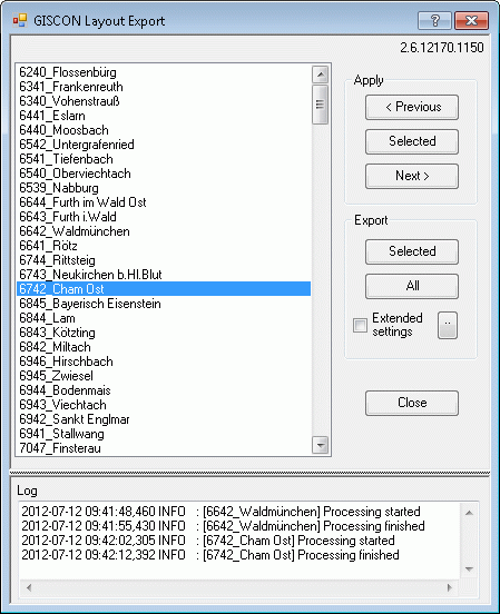
With this tool, consultants can
- individually select and visualise each page of a series
- export each individual page or the complete series
- select the corresponding output format according to application (ps, pdf, tif, jpg and png)
- define further parameters supported by ArcGIS® (resolution, compression or colour space)
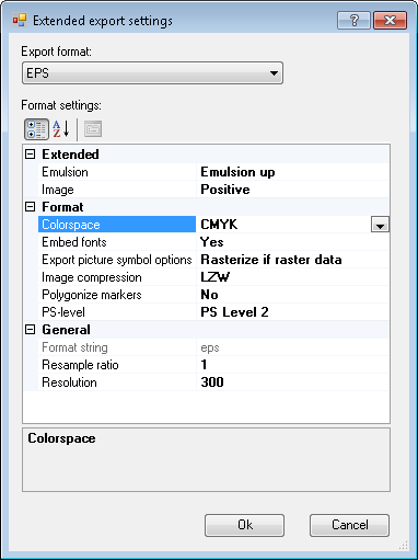
As a general rule, the main application is the high quality file export as a print file, which is preset as a default (PDF, CMYK, 300 dpi), but can still be adapted to customer specifications by means of a configuration file. Further applications are e.g. the export of the entire series in low resolution for trial purposes (preview) or in high resolution, in order to create a special image catalogue. For individual post-processing, the whole series or selected individual pages can be exported in MXD single projects. In this way, the user can carry out final modifications or final touches on individually exported map pages (the solution of complex anomalies).
Actions completed for each page change
- interpretation of system and text variables (e.g. system time)
- implementation of rules for the map elements, as defined by the user
- triggering of additional KTS special tools (amongst other things: adjusted page size, the addition of cut and fold markings, depiction of a coordination frame)